Palm Beach Oceanfront Vs In-Town Living: Key Tradeoffs
March 19, 2026
March 19, 2026
Are you picturing sunrise on your own stretch of sand or cappuccino on Worth Avenue a few minutes from your door? Choosing between oceanfront and in-town living on Palm Beach Island shapes your daily rhythm, from how you reach the beach to how you run errands and host guests. In this guide, you will see the real tradeoffs so you can match your lifestyle to the right address. Let’s dive in.
Beach access in Florida follows a clear rule: the State holds the wet sand seaward of the mean high‑water line in trust for public use. The dry sand upland can be private unless a public easement or a recognized customary use applies. You should not assume all sand is public in front of any home; access is address specific. See the State’s public trust doctrine in Article X, Section 11 of the Florida Constitution for the baseline rule.
In 2025, Florida enacted Senate Bill 1622. The law restores more local authority to recognize recreational customary use and streamlines some beach restoration procedures. It does not automatically convert privately owned dry sand into public property. Outcomes can depend on local ordinances and, in some cases, litigation.
On Palm Beach Island, the Town maintains designated public access points with posted hours, rules, and amenities. Public beach hours are sunrise to sundown, lifeguards are typically on duty 9 a.m. to 5 p.m., and alcohol and most smoking are prohibited on public beaches. Streetside parking uses ParkMobile zones and resident permit rules. Always confirm the nearest legal access point and its amenities for a specific address using the Town’s Comprehensive Plan resources and current FAQs.
Florida Constitution, Article X §11
Town Comprehensive Plan and Beach Access Map
Town FAQs: beach rules and parking
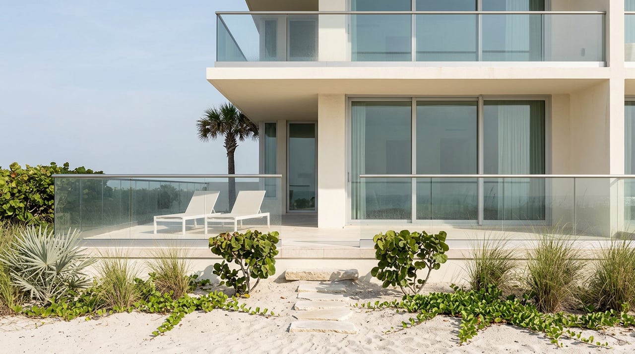
Palm Beach’s in‑town blocks around Worth Avenue and Royal Poinciana Way allow town‑serving shops and moderate‑density residences. Smaller lots, sidewalks, and mixed uses support a walkable lifestyle. By contrast, much of the oceanfront sits in beach or estate categories with fewer commercial uses and more restrictive development forms. This pattern shapes not only what you can build, but also what your day looks like on foot versus by car.
GIS and downloadable maps index
Walkability on the island varies by block. The in‑town core near Worth Avenue and Royal Poinciana Plaza often scores in the 60s to 70s on Walk Score, which means you can run many errands on foot. Many true oceanfront addresses show single‑digit or low double‑digit scores, so you will likely drive for groceries and services.
A quick way to test your lifestyle fit is to run the exact address on Walk Score and note what daily tasks you can do without a car.
From November to April, seasonal residents and visitors drive demand on island roads and parking. The Town’s Comprehensive Plan notes that traffic and limited parking can reach critical levels in peak season and outlines strategies to manage circulation, including coordination on bridge openings during rush hours.
For guest and permit details, consult the Town’s parking guidance and check specific public lots or ParkMobile zones before hosting larger gatherings.
Town Comprehensive Plan: mobility policies
Town FAQs: parking and permits
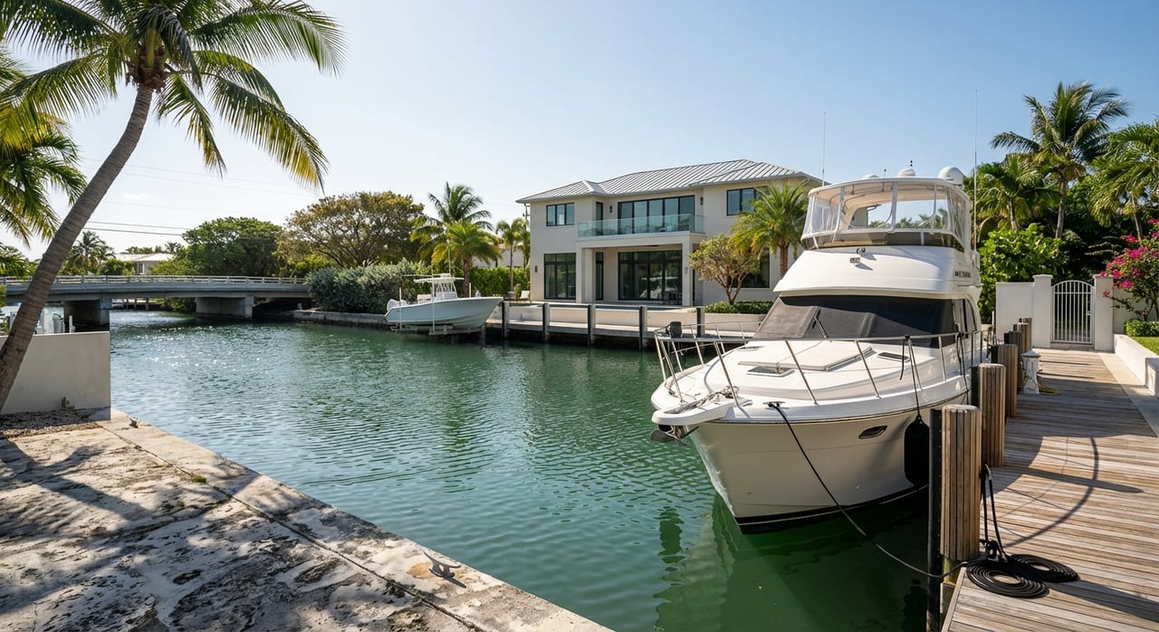
Privacy and security feel different in each setting. Oceanfront estates and certain resort properties offer a high degree of spatial privacy and access‑controlled amenities. Private clubs shape a distinct social calendar for members and guests.
In‑town, you are closer to the island’s commercial and cultural heart. Worth Avenue and Royal Poinciana Plaza bring boutiques, galleries, and cafés within a short walk, along with a steady social pulse.
The Town invests in public safety and policing, with staffing and policies outlined in official reports. While crime levels can vary, the Town’s focus on preserving quiet and enforcing property rights is clear. For any purchase, consider proximity to services, your privacy expectations, and how you like to entertain.
Many oceanfront parcels sit within FEMA coastal VE or AE zones, which reflect storm surge and wave exposure. That typically means stronger construction standards, potential seawall requirements, and higher flood insurance premiums. The Town and county map series identify Coastal High Hazard Areas and floodplain layers so you can confirm a parcel’s status.
Florida’s 2025 SB 1622 also streamlines certain beach restoration procedures, which matters for shoreline nourishment projects. For any oceanfront or near‑shore purchase, request the elevation certificate, survey, easements, and an insurer’s quote for the specific address before you finalize terms.
Town Comprehensive Plan: coastal and hazard maps
Florida Senate SB 1622 (beach restoration context)
Use this simple list to pressure‑test a favorite address:
Ready to compare specific streets, buildings, or parcels side by side? Our brokerage can help you weigh lifestyle fit against ownership details like access, insurance, and approvals. For a tailored conversation, reach out to Gail Kennell and our team.
Discreet Horizons is the forensic intelligence arm of Sea Crown Estates. In an era of increasing transparency and shifting coastal codes, we provide the situational awareness required to protect coastal legacies.


The Singular Mandate
The Expired Asset

Sea Crown Estates

Sea Crown Estates
Specializing in luxury real estate, Sea Crown Estates delivers discreet, white-glove service with curated listings, expert insights, and a bespoke approach tailored to every client’s vision.